BRACU Alter at RoboCup Rescue 2024
AI Team Lead: the five-person AI team within the BRACU Alter squad
February 2023 to August 2024
A rescue rover that has to find hazard signs in a collapsed building and put them on a map, built by a university squad on a student budget. I led the five-person AI team inside that squad.
Outcomes
95%
hazmat sign detection accuracy
On the vision pipeline, running on the robot's own edge hardware (a Jetson Xavier and a Raspberry Pi), not on a workstation with the frames streamed off the robot.
50%
reduction in mapping hardware cost
A 2D/3D mapping architecture I proposed that reached the performance we needed on half the sensor budget. On a student-funded team this is the difference between building the thing and not.
Global finalist
RoboCup Rescue 2024, Eindhoven
The robot reached the final. I worked on it from Dhaka and did not travel to the event.
The problem
RoboCup Rescue sets robots loose in a mocked-up disaster site: rubble, ramps, no reliable radio, no map. A robot scores by finding hazardous-material placards, reading them correctly, and reporting where they are. Not just that a sign exists, but where in the building it is.
Two constraints shape everything. The compute has to ride on the robot, so it is a Jetson Xavier and a Raspberry Pi rather than a workstation. And the whole thing is funded like a student project, which turns every sensor choice into a real decision.
My team's slice of it
BRACU Alter is a squad split across mechanical, electronics, control and AI. I led the AI team (five people) and we owned the part between the cameras and the map: navigation under ROS Noetic, detecting and classifying the hazmat signs, and turning a detection into a coordinate somebody could act on.
That scoping matters. The chassis, the drivetrain and the firmware were other people's work, and the squad had its own team lead.
What we built
A computer vision pipeline for hazmat placard detection, running on the robot's own hardware rather than streaming frames off it. Detection alone is not worth much in this event, so we fused it with RealSense depth data: once a sign is detected in the frame, the depth reading places it on the live map at the position it was actually seen from.
The mapping architecture was the decision I am most pleased with. The obvious build for 2D and 3D mapping wanted sensors we could not justify. I proposed an alternative arrangement that held the performance we needed on a substantially cheaper sensor set.
Photographs and video
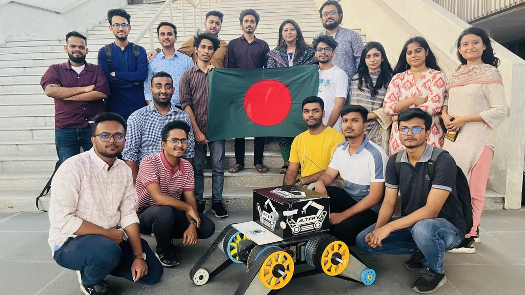
The BRACU Alter squad with the rover.
Not published yet: one or two more photographs, ideally the rover on its own, close enough to show the tracks and the sensors. And who took Alter_team.jpg, so it can be credited.
Produced by BRACU Alter. Team context, not a record of my own work.
Link not yet verified; see the open items note in the repository.